Feeds:
Posts
Comments

Archive for the ‘state of Jefferson’ Category

Crater Lake goodbye

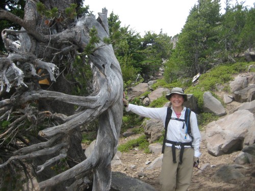
During my last week of work at Crater Lake Science & Learning Center, my co-workers took to lunch at the Lodge.  One of them even brought me flowers!Lia at Crater LakeIt was an honor to work at Crater Lake for three summers, and exciting to be a part of the Crater Lake Science & Learning Center, which has only been operating for four years.  At our year-end accomplishments presentation, the park superintendent said that Crater Lake’s Science & Learning Center was considered to be one of the most effective science and learning centers in the park service!

Science & Learning Center team

Linda, Andy, Marsha, me, and Mac

Here I am with the whole team.  I’ll miss working with them!

Read Full Post »

View from the window

fall colors out the window

Yesterday morning as I stood in the master bathroom getting ready to go out running, I looked through the bedroom and out the windows above the bed, and noticed for the first time how vibrant the fall colors have become already.

Already fall?  Impossible!  Yet, it’s October now, and we’ve spent just a week over a year in this house.  It’s been a good year, and we’ve enjoyed the house.  The future is a bit uncertain at this point, but we will move out in about 3 weeks, and do some traveling, and then?  A new job for me, probably.

I always look forward to the future and whatever comes next, but I sometimes stop and experience a period of sadness about leaving a place.  That’s where I am now– thinking “this may be the last time I walk this trail,” “this may be the last time I eat at this restaurant,” or “this may be the last time I see this acquaintance.”

There’s a school of Dutch painting that involves landscapes as seen through a window of some interior space, and I was thinking about that as I took this photo.  I certainly don’t know much about the theory behind this style of painting and I wasn’t under the illusion of taking an “artsy” photo, but now that I download the picture and get a better look at it, I really have to laugh at myself.  The blue electrical tape around the window sills glare out of the picture, defying any idea at all of artistic composition.  The tape was a quick solution to the problem of ill-fitting window screens, which were failing to prevent the plentiful midges from getting in at night, and everywhere in this oh-so-white house, the blue stands out starkly around the window sills.

So, I’ll take that as a metaphor– a cautionary note against too much nostalgia for a time or a place– and someday years from now, I’ll probably find this picture and remember the good year in this lovely view house, and laugh about the tape and the hordes of midges that occasioned its use.

Read Full Post »

The North Fork of Little Butte Creek is dammed as it comes out of Fish Lake, but the spill valve was letting out a huge surge of water on the day we hiked the trail along the creek.  Apparently, the creek’s flow is controlled all the way down to Medford, where its water is used to irrigate the orchards.  I bought some Medford peaches last weekend and eagerly tasted them.  Maybe it’s too early in the season, or maybe it’s a bad year for peaches– but hiking the trail was a far more pleasant experience.

Read Full Post »

Mt McLoughlin

Bo at the trailhead sign, sort of

It was the place to be on a Saturday in mid-August!  We just didn’t know it until we arrived.  We’d been sort-of planning to climb Mount McLoughlin since last year, and definitely planning to climb it since last week.  Not until we were on our way to the trailhead did Bo mention that the Klamath Falls Herald and News had printed a front-page article on hiking this trail just a few days before.  “Great!” I said, “We’ll have all of Klamath Falls up there with us!”

whitebark pine and me

Mt. McLoughlin is the southernmost “big” peak in the Oregon Cascades.  At just a smidge under 10,000 feet, the ascent consists of a hike and then a bit of  scrambling or bouldering near the top, where the ground is unconsolidated and covered with rocks large and small (anchored and not- anchored).  In the summer, you don’t need any special equipment, just a decent set of lungs and joints.  It’s nothing to sneeze at, either, though.

When we parked at the trailhead, sure enough, there were almost two dozen cars already there.  We cleverly arrived at least two to three hours after most self-respecting hikers would have started up the trail, so that gave us the feeling of relative solitude.  Of course, we saw lots of people on their way down, including the entire Mazama High School football team (that would be the Vikings– see my earlier post about midges– it took me a minute to figure out that it wasn’t a bunch of teenaged boys who all just happened to be fans of Minnesota’s NFL team).

lunch stop, and first panoramic views

The first 3.5 miles or so were really nice– a bit of climb, but mostly smooth walking through a forested landscape.  The last mile and a half or so are the part that take some fortitude.  Above treeline, this part of the trail is not very well-defined, and it involves climbing over boulders and/or sliding your way through ashy, volcanic dirt, and at a fairly high elevation that might make you short of breath or make your head a bit spinny when you stand up from the crouch you’ve been in as you hop and crawl along.  And then, finally, after yet another break to catch our breaths and enjoy the view– voila! we climbed over another rock, and there was nowhere else to go!  I actually asked a woman sitting next to a rock if this was the top (it must have been a side-effect of the shortage of oxygen; normally I would never ask a stranger a dumb question like that).

ah! Summit!

So, that was it.  We sat for awhile, ate some food, Bo took video and I took photos, I rooted around in the foundation of the old look-out tower until I found “the canister” (a mountaineering tradition: a container where you can put a piece of paper with your name and the date you were there), which turned out to be an empty plastic Gatorade bottle stuffed with business cards and such.  I didn’t have a pen with me and had to use the burnt end of a stick as a charcoal pencil on the back of a piece of paper ripped off my photocopy of the trail guide.  The sky was hazy with smoke from nearby wildfires, and some weather seemed to be coming in, too, but we could still see Mt. Shasta to the south and most of the the closer peaks.  There’s just something about being up at the top, above treeline, that is different from any other experience– any other hike, or even flying over in a small plane.

The clouds getting darker and gathering over our heads, we came down.  Bo proposed pizza and beer at a Klamath Falls brewery, and I think that sped our steps.  When we got back to the parking lot, most of the cars from the morning were gone.  And that was it!  We did it.

Read Full Post »

Phantom Ship

August 18, 2010

Read Full Post »

Midges

There are two public high schools in Klamath Falls.  Klamath Union’s mascot is, very appropriately, the Pelican, while Mazama High School’s is a Viking, which doesn’t make any sense to me at all.  At any rate, my point is that if Klamath Falls itself were going to adopt a mascot, I would nominate the midge.

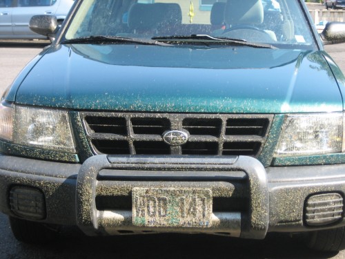
The lowly Klamath midge, known to some by its scientific name, Chironomus utahensis, is the adult form of a type of bloodworm.  Most Klamath Falls residents simply know it is the annoying insect that swarms up out of the marshes and lakes mid-summer, forming small dark vortex-shaped clouds that subsequently get into the grill of your car or swarm into your house when you accidentally open the door at the wrong time.

We’ve been working on anti-midge strategy here at home.  Joda has a habit of sitting out on the deck after dinner.  Since midges are attracted to light, we’ve learned to turn off all the kitchen lights for a minute before opening the door (just a crack!).  Even Joda seems to understand that speed is of the essence, as we turn the door handle but wait to open the door until we see her hind legs tensed and her tail tucked, ready to hustle outside fast before we shut the door firmly behind her.  Early failures to follow this procedure led to piles of midge carcasses on the kitchen counters, along the cupboard door hinges, or for the ones that survive inside until morning light, on the windowsills.

morning: storming the windows

The midge is native to the area, and other than being ridiculously plentiful, noisy (think of an overwhelming,  constant whine), and annoying, they don’t do any harm.  They don’t bite, they don’t carry disease, they don’t crowd out other species.  In fact, as nature writer Frank Lang points out, their larvae, the blood worm, is a favorite food for larger insects and small fish, all of which are in turn devoured in huge quantities by the local trout that then grow to trophy sizes.

midge-splattered car

They do get so plentiful along the main high-speed highways that run north-south along either side of Klamath Lake that you’d think fatal car accidents could be caused by drivers suffering from temporary loss of vision at twilight or at night.  But, my research for this post didn’t extend far enough to turn up any stats on this kind of thing.

Meanwhile, the notoriety of the midge seems to give a small boost to the local economy.    Yesterday we drove by a carwash business with a sign promising to “de-midge” your vehicle.  The coffee shop in my neighborhood offers a frozen espresso drink called “the midgie” (my research on this front fell short, too, but I think it involves small green mint sprinkles in a brown frozen latte base).  And one of the bars downtown includes a “midgie burger” as part of its line-up of gourmet hamburgers (guacamole and chopped black olives are involved in this one).

So, despite some inconvenience and a bit of mess, the midge is a rather benign character, just one more part of our curious Klamath landscape.

Read Full Post »

I’m treating today as a lazy Sunday: sleeping late, drinking coffee (made by Bo) and eating pancakes and bacon (also made by Bo) before heading out to the hammock to read a book and stare out over the water, where some people who are less lazy than I am are taking advantage of a perfect summer day on upper Klamath Lake.

Read Full Post »

Golden Dome CaveAbout 45 minutes south of Klamath Falls, just over the California border,  is Lava Beds National Monument.  It’s a strange, flat landscape dotted with cinder cones and littered with dark brown basalt rock.  When you look a little closer, you realize that it is also littered with lava tube caves.

In my opinion, the caves are a nice thing to have around here, where daytime temperatures often reach 100+ in the summer and any given day is likely to be marked by unpredictable high winds, clouds of tiny midges or buzzing mosquitoes, rain, or snow.  The caves, for the most part, provide respite from all these elements, while still offering a change to explore and have fun doing something particular to the area.

The photo above is the entrance to Golden Dome cave, which didn’t seem very special at first, but once we had walked in about 1,000 feet– very slowly, as our eyes adjusted to the minimal light coming from our headlamps and our feet got used to the jagged, rocky floor– we saw the reason for the cave’s name.  The ceiling and walls of the cave are colonized by hydrophobic yellow bacteria, and when rainwater drips down through cracks in the ground, they shine like veins of gold.

Sunshine CaveWe explored Sunshine Cave, in which the roof has collapsed in a few places, letting in sunlight and allowing vegetation to grow.  I think my favorite cave of the day, that I hope to go back to again, was Valentine Cave.  It was discovered on Valentine’s Day in 1933, and is younger than the other caves we explored.  Most of it is very large, with smooth floors.  Right at the entrance is a huge round column connecting the floor and the ceiling, where the lava flow went completely around the rock.  Here’s a photo, though it might be hard to see the giant rock column.Valentine Cave

Read Full Post »

Correction

Okay, so I was a little overzealous in my post about the state of Jefferson.

It wasn’t until I read some comments thanking me for the science lesson that I started thinking about what I had done.  What I did was unscientific, and unfitting for a journalist or teacher (or even blogger) of any kind.  I said that the water coming out of the spring at Spring Creek is from Crater Lake, when in truth, no one actually knows whether or not this is the case.

While it is generally accepted that water does seep out of Crater Lake (at the rate of 89 cubic feet per second, according to Kenneth Phillips’ 1968 paper), no one has ever demonstrated that it seeps out at any particular place other than on the northeast side, where the side of the caldera has a lot of unconsolidated gravelly material.  In 1968, Phillips’ measurements indicated that the amount of water produced by Spring Creek alone was three times the amount lost by the lake to seepage (see link above).  So, while it is certainly not impossible that Spring Creek is sending Crater Lake water to the Pacific via the Klamath River drainage, no one actually knows for sure, and my description of the process was rather simplistic and, well, presumptuous.  It made for a better story, though, didn’t it?

Maybe so.  But, as much as I’d like to be a good tale-teller, I can’t do it at the expense of the truth and the scientific method.

So, where is the rest of that Spring Creek water coming from?  Stay tuned (possibly for a long, long time…)

Read Full Post »

Welcome to the State of Jefferson! Greetings especially to all of the Blogtrotters who are dropping in for the day.

I am writing from Klamath Falls, Oregon, very close to the border with California.  But since 1941, many of the counties in southern Oregon and northern California have called themselves the State of Jefferson, after the third US president.  There have been many reasons– political, topographical, and cultural– for the creation of this fictional state.  I won’t get into those.  For me, this area is all about water– water of many forms, states, temperatures, and in many places.  As is often true in the American West, the water is a cause of and solution to many problems, and the source of many conflicts between people– farmers, native people, boaters, ranchers– and the local plants and animals.  About ten years ago, Klamath Falls made national news because of the dramatic and somewhat violent clash between federal land managers, who shut down the irrigation due to drought and the survival of an ugly little group of species called the suckerfish, and the farmers and ranchers who formed actual bucket brigades to continue irrigating anyway.upper Klamath Lake I live on Upper Klamath Lake, which is very long and shallow– only about 6-8 feet deep in most places.  It is also what lake scientists call hypereutrophic, which basically means that lots and lots of stuff live in it– bacteria, algae, plants, fish, and so on.

If you drive about an hour north of my house, you get to the north end of this crazy lake and, after driving up a mountain, you wind up at the deepest lake in the United States: Crater Lake. Crater LakeCrater Lake sits in the caldera of a volcano that is still considered active– Mount Mazama.  The lake is nearly 2,000 feet deep, and lake scientists call it ultraoligotrophic— which basically means that there is hardly any life growing in it at all, because it the water is so cold and pure.
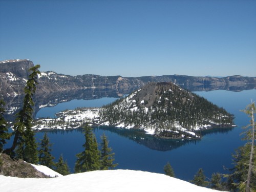
I love the contrast of these two totally opposite bodies of water being right next to each other.  It’s like the two siblings whose personalities are completely opposite being forced to share the back seat of the car for a long family road trip.  “You think you’re so deep and mysterious??  Well, I have most of the surface area of the back seat, so there!”  “Well, if you think I am going to waste my time talking to someone as shallow and germy as you, you can just forget it!”

Spreing CreekOf course like all siblings, even those who are complete opposites in personality, these two bodies of water share common blood.  Crater Lake  contains such a large volume of water and is at such a high elevation, that some of the water escapes.  To the southeast of the lake, there is a little stream called Spring Creek that originates as freezing cold, pure water that comes out of the ground in hundreds of springs and then makes its way to the Williamson River, which feeds Upper Klamath Lake.

Spring Creek

one of the springs that feed Spring Creek

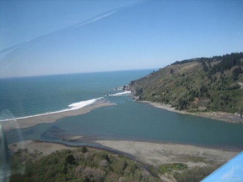
Then the water (all of it that doesn’t get captured for irrigation, anyway) makes its way from Upper Klamath Lake into the Klamath River and south into northern California, where it curls west and north again, collecting more and more tributaries, until it enters the ocean near Crescent City, CA, just a hair south of the Oregon border.  So, you see, even the ultraoligotrophic water eventually mixes with the hypereutrophic water and it all goes to the same place: the Pacific Ocean.mouth of the Klamath RiverJust like our mixed up watershed, there are lots of different people and lifestyles in the State of Jefferson.  From sunbaked ranchers east of town to Shakespearean actors over the mountains in Ashland, from retired lumberjacks to retired bankers from the Bay area, to hippie bakers to F-15 pilots at the military base– there are all kinds of people here.  And despite the disagreements about various issues like water and how to use it, I’ve found the atmosphere to be one of friendliness and care.  So, I hope that you blogtrotters out there will come and explore this place non-virtually some day!
PS:  Please be sure to read the correction I put up after writing this post!

Read Full Post »

Older Posts »